
Back to Equipment
Survey
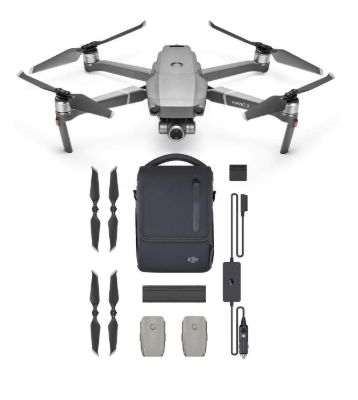
Drone survey
✔ Available for Booking
Pricing
:
₹ 0.00 + 18% GST
Payment Type:
Sample
Description
Application: It is primarily used for aerial photography and videography, capturing high-resolution images and videos from elevated perspectives. Additionally, it plays a crucial role in mapping and surveying, providing accurate geospatial data for land assessment, urban planning, and environmental monitoring. Its advanced imaging capabilities make it valuable for applications in agriculture, construction, and disaster management.
Spectations:
Model: DJI Phantom 4 RTK
Mavic 2 Pro Camera; 1” CMOS sensor
Effective Pixels: 20 million
FOV: about 77° 35 mm
Format Equivalent: 28 mm
Aperture: f/2.8–f/11
Shooting Range: 1 m to ∞
ℹ Equipment requests can be placed for only one campus at a time.